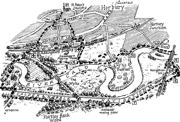
THIS MIGHT seem a bit elaborate for a
walks book but I'd like my book of Walks around
Horbury to be a bit different. In some walks books
the maps are clear but perhaps a bit cold, in mine I'd
like to celebrate the pleasures of getting out of town;
thirty minutes walk from the High Street you're there
between river and canal down amongst the valley's pastures,
marshes, subsidence flashes, canal-side willows and
ridge-top oakwood. In addition to the wildlife interest
there are plenty of reminders of the history of the
valley
I like picture maps in children's books
such those on the endpapers of The Hobbit
and Winnie-the-Pooh. In the BBC series Map
Man Nicholas Crane tests, on the
ground, a variety of historical maps, going back as
John Speed's and Christopher
Saxton's early surveys of Britain. Crane makes
the point that what is left out of a map is as revealing
as what is shown; a good example being the London Underground
map by Harry Beck.
This is my home patch, Addingford
in the Calder valley. There are a lot of memories there
for me, a lot of my own history. It's where I first
explored the countryside for myself when, as a schoolboy
aged 9 or 10, I'd wander off with my friends down towards
the canal. I was struck then, as I am now, by the way
the familiar small town world (depicted with bland grey
hatching in this map, there's my preconceptions
creeping in!) abruptly gave way to rough and rambling
countryside at Addingford Steps (middle, left).

