Richard Bell's Wild West Yorkshire nature diary
Millfield Lagoons
‹previous
| this month | home
page | e-mail me | next›

 Saturday,
23rd December, 2006
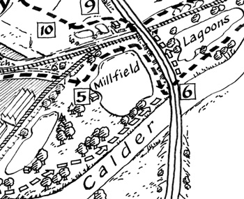
Here's the way I'm going with the maps for Four Walks Around Horbury;
it seems to be taking a long time and a lot of attempts to get the look that
I want. As this is for a walks book, I'd like to go for clarity rather than
for the rich organically textured look that I had tried to acheive in previous
maps.
On Thursday, to test the booklet out, I walked all four walks with my friend
Martin Housley; a total of 17, closer to 18 miles, and a total
ascent (and descent of course, as these are circular walks) of over 1,000 feet;
that's the height of Emley Moor television mast which at 330.4
metres (1084 feet) is the highest free-standing structure in Britain.
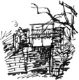
This stretch of the Millfield Lagoons walk involved paddling
through a puddle under a railway bridge (top right, point 5 on the map)
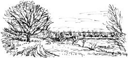
and meandering around in a boggy field (points 9 and 10) to find the
true line of the footpath  marked
on the map. I decided that anyone in this situation would prefer clarity on
the map rather than the stipply textured aerial view that I had considered.
The same thing applies to the directions. As Thursday was the shortest day
of the year we had to complete the last walk in the dark. Hopefully not many
of the people who use the book will be wandering around after dark but it brought
home the point that clear, concise, legible instructions are a great help.
Link: Emley
Moor in Wikipedia
‹previous
| this month | home
page | e-mail me | next›

 Saturday,
23rd December, 2006
 marked
on the map. I decided that anyone in this situation would prefer clarity on
the map rather than the stipply textured aerial view that I had considered.