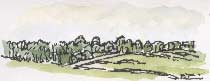
 THERE'S
A WATERY LIGHT over the broad valley around Shepley, in the foothills of the
Pennine moors, as seen from the café at
Armitage's Garden Centre, Shelley. We're here to check out
book stocks; sales of my walks books came to a sudden stop when this persistently
watery weather
started weeks ago and the garden centres have felt the effects of the weather
too, especially in the barbecue department.
THERE'S
A WATERY LIGHT over the broad valley around Shepley, in the foothills of the
Pennine moors, as seen from the café at
Armitage's Garden Centre, Shelley. We're here to check out
book stocks; sales of my walks books came to a sudden stop when this persistently
watery weather
started weeks ago and the garden centres have felt the effects of the weather
too, especially in the barbecue department.
CCC Mitchell's, the big camping store
at
the end of
our road, had water running in the back door, right through the store and
out of the front door. This weekend they had a huge sale of flood-damaged stock
which attracted so many customers that the police had to deal with the
flood of traffic.
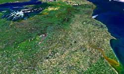
The satellite view of northern England (right) is a
NASA image, generated by their World
Wind program. Flamborough Head is the spur projecting
centre right with Spurn Head at the mouth of the Humber, lower
right.
 Geocover
2000
Geocover
2000
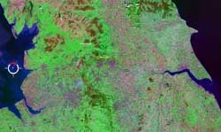 You
can display the Geocover 2000 satellite survey in World Wind
which uses false colour to emphasise differences in vegetation. In this image
(left) the Pennine hills stand out in bright green
with maroon-brown moor tops while the North Yorks Moors appear
in a similar colours in the top right (north-eastern) corner of the image.
You
can display the Geocover 2000 satellite survey in World Wind
which uses false colour to emphasise differences in vegetation. In this image
(left) the Pennine hills stand out in bright green
with maroon-brown moor tops while the North Yorks Moors appear
in a similar colours in the top right (north-eastern) corner of the image.
The gentler, rolling
hills
of the Wolds are less striking
but visible as a lighter, more bluish green band crossing the Humber estuary
down into Lincolnshire on the eastern side of the map. They follow the outcrop
of chalk across
England.
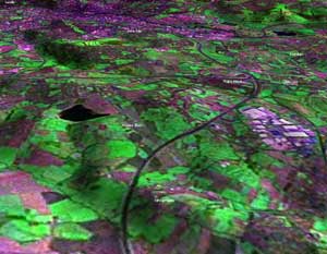
A close-up view of West Yorkshire (right) shows
the M1 snaking north with the Trans-Pennine M62 motorway, less conspicuously,
crossing from east to west.
This shows World Wind's ability to view the satellite image obliquely and generate
a three-dimensional relief map. East Ardsley reservoir is the dark patch on
the left, the light area on the right is the junction 41 industrial estate.
 Google
Earth
Google
Earth
 For
finer detail you're better off with the aerial survey used by Google
Earth,
which can also be viewed as a relief map.
For
finer detail you're better off with the aerial survey used by Google
Earth,
which can also be viewed as a relief map.
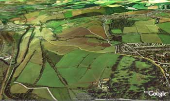
This view (left) shows our regular longer walk, not
that we've done it much during this wet summer, from Coxley Valley,
the woods in the background, along Smithy Brook Lane, which runs diagonally
just above
the centre of the image, through Thornhill Park (lower right) and
back alongside the canal (left, running parallel to the River Calder).
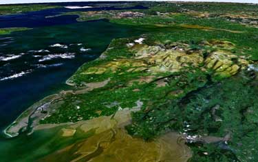
One final NASA World Wind image; Morecambe Bay and,
rising beyond it, the Lake District(right). This
looks more impressive full screen and of course, if you're using the program,
you can of course
zoom in to
areas
of interest by scrolling with your mouse-wheel and, by clicking with your mouse,
you can make your way in hovering hops - it feels like riding on a child's
scooter - across the Cumbrian hills towards the Solway Firth
and
Scotland.