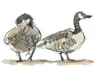
 APART
FROM the usual gaggle of Canada geese accompanied
by moorhens down on the narrow pasture between canal and river we saw very
few birds.
APART
FROM the usual gaggle of Canada geese accompanied
by moorhens down on the narrow pasture between canal and river we saw very
few birds.Rambling round the Valley |
Richard Bell's Wild West Yorkshire nature diary, Saturday, 5th January, 2008 |
APART
FROM the usual gaggle of Canada geese accompanied
by moorhens down on the narrow pasture between canal and river we saw very
few birds.
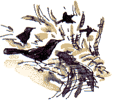
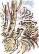
At the entrance to the wood there were plenty of blackbirds,
but we’ve seen as many in our back garden during colder spells. This
morning, on my way to post some of my published sketchbooks to Albuquerque,
New Mexico
(I’m
amazed how far afield my sketchbooks go!) I saw a grey wagtail flitting
about
on the silty, drift-rubbish-strewn edge of the river.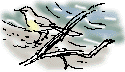
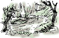
 The
most dramatic sight in our end of Coxley Valley was the results
of the watercourse corridor clearance work, carried out last month. The chainsaws
were whirring for days as they took out a lot of the old crack willows that
lean drunkenly across the beck. There’s
a tributary stream which previously you were hardly aware of before because
it was lost amongst tall willows. They're all neatly stacked in what should
prove useful habitat piles.
The
most dramatic sight in our end of Coxley Valley was the results
of the watercourse corridor clearance work, carried out last month. The chainsaws
were whirring for days as they took out a lot of the old crack willows that
lean drunkenly across the beck. There’s
a tributary stream which previously you were hardly aware of before because
it was lost amongst tall willows. They're all neatly stacked in what should
prove useful habitat piles.
It looks pretty drastic but even this piece of flood management hasn’t solved all the problems; water is bubbling up at the entrance to a small paddock by Coxley Mill and flowing down the footpath into the stream. A culvert about 50 yards long runs from another old mill (currently being reconstructed by a mill-engine enthusiast). Clearing any blockage in there is going to be difficult.
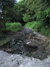
The potholed path (left), damaged in last summer's floods was repaired and resurfaced in early autumn.
 The
clearance of some of the tumbled willows opens up the view of the floodplain
near the old quarry. It looks to me as if this flat area is the silted-up bed
of an old dam, probably providing a back-up for the corn-mill
which used to stand downstream, where the Capri Restaurant now stands
near Horbury Bridge. The car park in front of the Capri is
where the dam for the water-wheel lay, although
it’s disappeared under some 10 feet of back-fill, but the shape is still
there, in the outline of the car park and filling station next door.
The
clearance of some of the tumbled willows opens up the view of the floodplain
near the old quarry. It looks to me as if this flat area is the silted-up bed
of an old dam, probably providing a back-up for the corn-mill
which used to stand downstream, where the Capri Restaurant now stands
near Horbury Bridge. The car park in front of the Capri is
where the dam for the water-wheel lay, although
it’s disappeared under some 10 feet of back-fill, but the shape is still
there, in the outline of the car park and filling station next door.
So my guess
is that there was a second dam, 200 yards or so upstream, to top up the mill
dam. When you walk into the wood you climb an earthwork which could be the
remnant of the dam wall, then near the old quarry spoil has been piled up
so that there's a steep embankment along the side of the floodplain and this
corresponds with another
banking, now an old hedgerow, which I suggest was once the opposite bank.