 |
Trees in the GravelsMonday, 14th October 2002, West Yorkshire |
![]()
![]()
![]()
![]() Rocks |
History |
Workshop |
Links |
Home Page
Rocks |
History |
Workshop |
Links |
Home Page
![]()
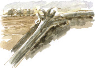
 How old are the tree trunks that turn up from time to time in the and gravel beds of the Calder valley? A naturalist friend rang me the other evening to ask if I had any ideas about the origins of a large tree which has been dug out of the gravel workings at Grange Farm, between the river and the Denby Dale Road, south of Wakefield.
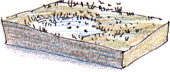
 As I've written before in this diary, the Calder is what you might call a misfit river sitting in its broad valley near Wakefield doing little more than redistribute the silt on the flood plain. It doesn't seem likely that the present river, even in flood, could have carved out the valley by itself or that it could deposit such vast quantities of sand and gravel across its flood plain.
The Atlantic Period
 Much of the work of enlarging the valley was probably done by meltwaters
during the last ice age when the Calder valley remained ice-free, although
their was a glacier in neighbouring Airedale, a little to the north.
 As I understand it the gravel deposits are more likely to date from after the
ice age, perhaps from a time when it was wetter and warmer than it is today;
the Atlantic Period, 7,500 to 5,200 years before the present day (or 5,500
B.C. to 3,200 B.C. if you prefer). The gravels probably contain of material
of ice age origin which has been eroded and then redeposited by later rivers.
As I understand it the gravel deposits are more likely to date from after the
ice age, perhaps from a time when it was wetter and warmer than it is today;
the Atlantic Period, 7,500 to 5,200 years before the present day (or 5,500
B.C. to 3,200 B.C. if you prefer). The gravels probably contain of material
of ice age origin which has been eroded and then redeposited by later rivers.Carbon Dating
 The particular tree that we were looking at today was tall and straight. It might be as old as the gravels or it may have been deposited in a channel cut into existing, and therefore older, gravel bed. It has been dragged out to the edge of the workings so we can't get any precise answer on that. The results of a radio carbon date, or a tree ring analysis would be interesting because, even without a record of exactly where it was found in the gravel pit, the information might help shed some light on the evolution of the valley.
![]()
Richard Bell,
wildlife illustrator
E-mail; 'richard@willowisland.co.uk'
![]() Next page |
Previous page |
This day last year |
This month |
Nature Diary |
Home Page
Next page |
Previous page |
This day last year |
This month |
Nature Diary |
Home Page
![]()