 |
Bird's-eye ViewSaturday, 10th August 2002, West Yorkshire |
![]()
![]()
![]()
![]() Rocks |
History |
Workshop |
Links |
Home Page
Rocks |
History |
Workshop |
Links |
Home Page
![]()
 I spend so much time walking through the landscape, drawing it and researching it that when I get any chance to see it from a new perspective I take it. When we're flying if there's a choice between extra leg room and a window I'll always go for the seat with the view.
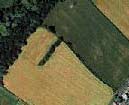
 So when an e-mail arrived this morning from my ISP Tiscali advertising their new Multimap service I went straight to the link. You simply type in your postcode and up pops an aerial view of the area around your house. If you can't get your bearings you have the option of adding a map overlay, based on OS data. You can navigate to adjacent views. I find it fascinating to follow our familiar local walks. It's surprising what features an aerial view can reveal.
The Causey Stone Path
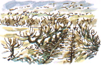
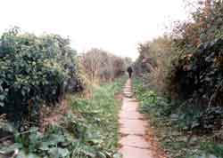
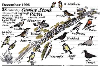
 For instance the elongated reversed 'S' shape in the detail of the view is a causey stone path leading diagonally from the wooded valley to the village. It's such a gentle curve that it's not easy to see at ground level. The reversed 'S' is the result of medieval ploughing. The ploughman started turning his team as he approached the end of the furrow. This shape can be seen in the individual strips into which the village's open field was divided as recorded on the tithe maps and enclosure maps of the 1700s and early 1800s and it can be traced right through to present day boundaries.
The short row of trees branching out from the path at right angles into the field follows an outcrop of sandstone which has been quarried in the past.

Related Link
Multimap can be found at the Tiscali web site. Richard Bell,
wildlife illustrator
E-mail; 'richard@willowisland.co.uk'
![]() Next page |
Previous page |
This day last year |
This month |
Nature Diary |
Home Page
Next page |
Previous page |
This day last year |
This month |
Nature Diary |
Home Page
![]()