|
1 p.m., Batley
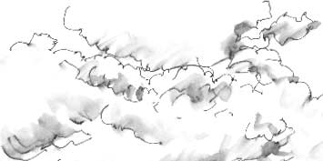
A big sky over the local Tesco car park: a bank of cumulus is moving
steadily in from the west over Upper Batley. A
map of a century ago shows a spur (now disused) of the Great Northern
Railway running along the foot of the slope towards Birstall.
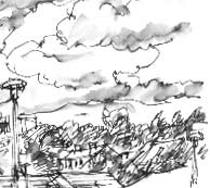
Batley High School is the prominent building on the ridge. The
suburb of Batley to the right of the school on the hill is Lamplands.
Other intriguing names in the immediate area are Soothill to the
east of Lamplands and Carlinghow facing it across the valley to
the west.
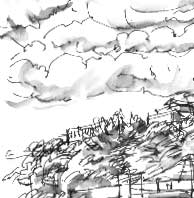
Carls were free peasants, how is a hill or headland.
Carlwark, an ancient hill fort near Hathersage,
occupies a commanding ridge top position.
As I sit with a cappuccino, I draw the clouds from the top down,
dabbing the black line with a waterbrush as I go to create the tonal
washes. 
|